
Before entering the BWCAW:
Obtain a visitor permit from an issuing station. There are daily entry quotas established for each entry point. Quotas are based on overnight use regardless of mode of travel and for motor day use. Because of heavy demand, it is suggested that you make advance reservations.
Leave cans and bottles at home. Non-burnable, disposable food and beverage containers including returnables are not permitted. Containers of fuel, insect repellent, medicines and other items which aren't food or beverage are permitted.
Consult Forest Service officials for current regulations. Campsites are designated. Do not camp in any site which does not have a fire grate and latrine. Party size is limited to reduce visitor impact.
Before entering Quetico Provincial Park:
Check with customs. You are entering another country. Obtain a visitor permit. Because of heavy demand, it is suggested that you make advance reservations. Consult Park officials for current regulations. Designated campsites are not required, but party size limitations do apply.
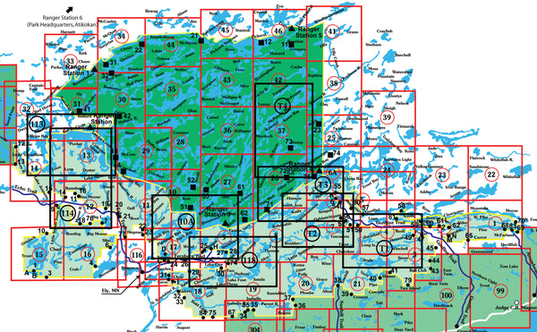
Map Legend:
 Entry points are listed in black text.
 Indicates center and number of each map.
View/Download high-resolution map index
mouse over to zoom
Map 1 - Pine, Greenwood and Mountain Lakes
This map details the eastern area of the BWCA. Including the last 6 miles of the Arrowhead Trail(County RD. 16)and BWCA canoe entry points; 66, 68, 69, 70, and 83.
Map 2 - East Bearskin, Clearwater and Alder Lakes
This map details the mid Gunflint Trail area, East Bearskin, Rose, Duncan, Hungry Jack, Clearwater and Alder Lakes. Including BWCA canoe entry points 59, 60, 61, 62, 64 and 82 and...
Map 3 - Ball Club, Winchell and Poplar Lakes
This map details the Mid Gunflint Trail area and the southeastern portion of the BWCA. Including BWCA canoe entry points 43, 44, 45, 47, 48, 49 and 79.
Map 4 - Gunflint, Loon and North Lakes
This map details the Mid Gunflint Trail area and the northeastern portion of the BWCA. Including BWCA canoe entry points 49, 50, 57, 58 and 81. For complete Gunflint Lake Depth...
Map 4A - Gunflint Lake with water depths
An ideal map for the angler. This map details the Gunflint Lake area with water depths. Scale is 1:31680.
Map 5 - Granite River Route, Magnetic, Gunflint and Northern Light Lakes
This map details the upper Gunflint Trail area and the northeastern BWCA area, including the popular Granite River Route, BWCA canoe entry points 50, 51, 52, 54, 54a, 55, 55a, 57...
Map 6 - Saganaga and Seagull Lakes
This map details the upper Gunflint Trail area. Including BWCA canoe entry points 51, 52 54, 54a, 55, 55a, 57 and 80. BWCA motor entry points J and K. Kekekabic Trail...
Map 6A - Saganaga, Saganagons
This map details the last 4 miles of the Gunflint Trail, Saganaga, Saganagons Lakes and Cache Bay. Including BWCA canoe entry points 54, 54a, 55, and 55a. BWCA motor entry points...
Map 7 - Little Saganaga and Tuscarora Lakes
This map details the upper Gunflint Trail area. Including BWCA canoe entry points 50, 51, 52, 54, 54a and 80. BWCA motor entry point K and the Kekekabic Trail hiking entry...
Map 8 - Knife, Kekekabic and Thomas Lakes
This map details the heart of the BWCA, Kekekabic Trail, Isle of Pines and a small southern portion of the Quetico Park. Including Quetico Park canoe entry point 71.
Map 9 - Moose, Basswood and Snowbank Lakes
This map details the eastern end of the Echo Trail. Including BWCA canoe entry points 25, 27, 28 and 30. BWCA motor entry points F, G and H. Kekekabic/Snowbank Trails hiking...
Map 10 - Basswood, Crooked and Sarah Lakes
This map details the BWCA and Quetico Park international border area including Basswood, Crooked and Sarah lakes north of Ely, Minnesota and Quetico Park canoe entry points 51 and 52. For...