
Before entering the BWCAW:
Obtain a visitor permit from an issuing station. There are daily entry quotas established for each entry point. Quotas are based on overnight use regardless of mode of travel and for motor day use. Because of heavy demand, it is suggested that you make advance reservations.
Leave cans and bottles at home. Non-burnable, disposable food and beverage containers including returnables are not permitted. Containers of fuel, insect repellent, medicines and other items which aren't food or beverage are permitted.
Consult Forest Service officials for current regulations. Campsites are designated. Do not camp in any site which does not have a fire grate and latrine. Party size is limited to reduce visitor impact.
Before entering Quetico Provincial Park:
Check with customs. You are entering another country. Obtain a visitor permit. Because of heavy demand, it is suggested that you make advance reservations. Consult Park officials for current regulations. Designated campsites are not required, but party size limitations do apply.
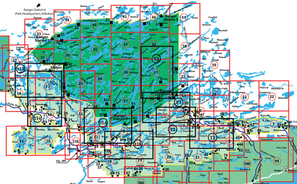
Map Legend:
 Entry points are listed in black text.
 Indicates center and number of each map.
View/Download high-resolution map index
mouse over to zoom
Map 34 - Quetico, Cirrus and McCauly Lakes
This map covers entry points 22, Sue Falls, and 31, Cirrus Lake. The map shows Cirrus, Quetico and Kasakokmog Lakes.
Map 35 - Sturgeon, Burntside and Jean Lakes
This map details the eastern interior of the Quetico Park. Including Sturgeon, Burntside and Jean, Allen, Lonely and Walter Lakes. No entry points are contained in this area.
Map 36 - Keefer, Williams and Camel Lakes
This map details the central interior of the Quetico Park. Including Keefer, Williams, and Camel, Sark, Vernon, Baird, Cairn and Burt Lakes. No entry points are contained in the this area.
Map 37 - Kawnipi Lake
This map details the southeastern interior of the Quetico Park. Including Kawnipi, Murdoch, Kenny Lakes and McKenzie and Kawa Bays. No entry points are contained in this area.
Map 38 - Powell Lake, Obadinaw and Wawiag Rivers
This map details the extreme eastern edge of the Quetico Park. Including Powell and Clay Lakes, the Obadinaw and Wawiag Rivers and Quetico Park canoe entry point 23.
Map 39 - Titmarsh, Plummens and Nelson Lakes
This map details the Titmarsh, Plummens and Nelson Lakes area east and outside of the Quetico Park. No entry points are contained in this area.
Map 41 - Tilly, Windigoostigwan
This map details the far North-East corner of Quetico Park, Including Tilly, Windigoostigwan, Huronian, Kabatay and Baril Lakes.
Map 42 - McKenzie, Cache and Buckingham Lakes
This map details the northwest interior of the Quetico Park. Including McKenzie, Cache and Buckingham Lakes.
Map 43 - Russell, Olifaunt Lakes and Maligne River
This map details the north central area of the Quetico Park including Russell, Fern, Alice, Sturgeon, Beg and Olifaunt Lakes and the Maligne River. No entry points are contained in this...
Map 44 - Soho, Kasakokwog and Oriana Lakes
This map details the north central edge of the Quetico Park including Soho, Kasakokwog, McAlpine, Lakin, Cole, Jim and Oriana Lakes. Quetico park canoe entry point 22.
Map 45 - Pickeral, Batchewaung and Nym Lakes
This map details the north central edge of the Quetico park. Including Soho, Kaskokwag and Oriana Lakes and Quetico Park canoe entry point 21.
Map 46 - Pickeral, Eva and Baptism Lakes
This map details the northwest edge of the Quetico Park. Including the French Lake Ranger Station, Pickeral, Eva and Baptism Lakes and Quetico Park canoe entry points 11 and 12.